Overview
Green stormwater infrastructure can be scaled by distributing practices across the project area. The site location analysis can be refined and expanded considering insights gained from sizing GSI practices. Adjustments can be made by cycling iteratively from sizing (to assess how GSI practices perform individually), to scaling (to construct coordinated GSI-at-scale design scenarios), and runoff reduction (to assess project performance when practices are coordinated together).
Exploration of six scales: soil, surface, site, city, system, and region. Coordinated GSI at multiple spatial scales that leverage the ecological functioning of the landscape (including native soils) as a design foundation is a better investment than opportunistic GSI (small-scale, piecemeal implementation based on factors of convenience).
Outcomes
After scaling GSI designs, conceptual GSI plans will optimize runoff reduction goals.
Recommended Involvement
The below offers broad recommendations for who might be involved in the scaling of GSI designs. As always, evaluate participation in accordance with your specific project.
Community engagement is useful in the process of scaling GSI to: assess community use of the proposed project area(s) (streetscape, shared public land, and private parcels); determine the potential for private land to be part of the design scenario; and to discuss design options with property owners (replacing turf with rain gardens, replacing parking pads and lanes with permeable pavers); and gather general community input into the design scenarios. GSI concept design plans are then formulated based on community engagement and show where and how GSI is recommended throughout the project area to achieve performance goals.
To learn more see the Engagement step of the design process.
Expertise helpful to the scaling of GSI includes:
- Landscape architect and/or engineering design, to create design scenarios and diagrams that distribute GSI practices across the project area.
- Community engagement, to facilitate a participatory GSI design process.
- Spatial analysis (data collection, analysis, and visualization; geographic information system software; map overlay creation), to aid in the scaling presentation and discussion.
- Engineering, to assess the potential of GSI design options to meet performance targets and to estimate costs.
- Planning, to coordinate GSI scenario land use with other types and scales of plans.
To learn more about professionals and their roles in GSI Design, see Who Might be Involved in GSI Design?
Local governments provide stormwater management program oversight, land use authority, and familiarity with ordinances—all are necessary for the task of scaling GSI. These contributions include coordinating GSI scaling, and assessing land that is considered in the scenario (public, private) in the context of the overarching land use planning and economic development objectives of the community. Local governments also provide regulatory guidance on the stormwater management objectives and co-benefits that will be met in exploring GSI design options, and inter-governmental coordination where projects expand across jurisdictional boundaries.
To learn more about the stormwater management authority of local government, see Illinois regulations.
Tasks
- Distribute GSI practices to project locations, considering:
- Using data-informed diagrams in conjunction with one another, including:
-
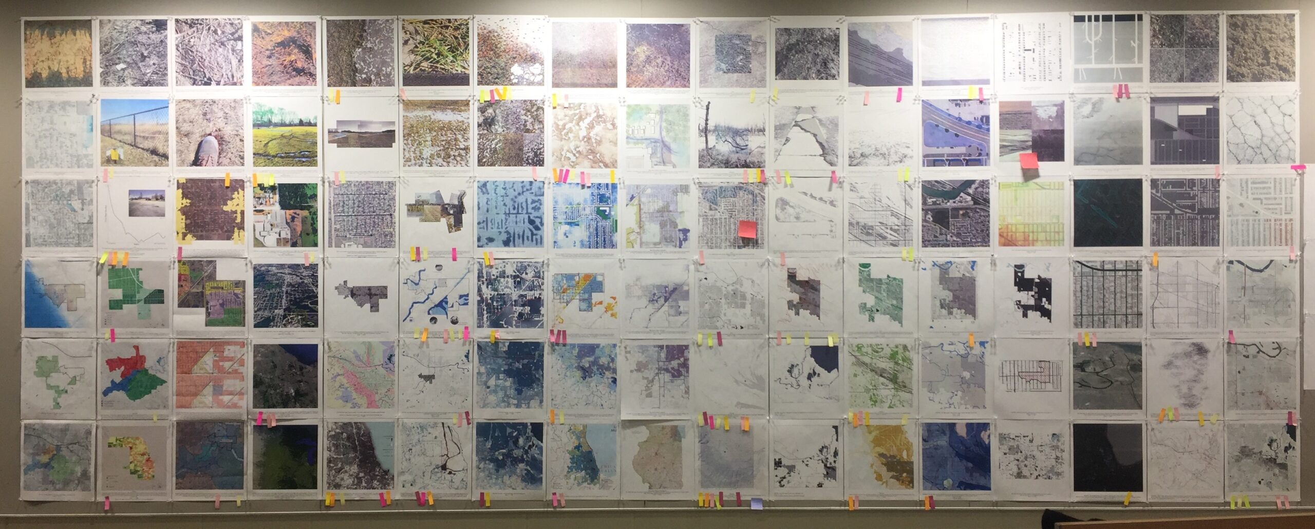
- Soils and soils analysis results (variation in native subsoils across the project area, for example: Bretz Map, Soils Characteristics for GSI Planning, Soils Map Units, Surficial Geology, Texture Class, Lithologic Cross Section).
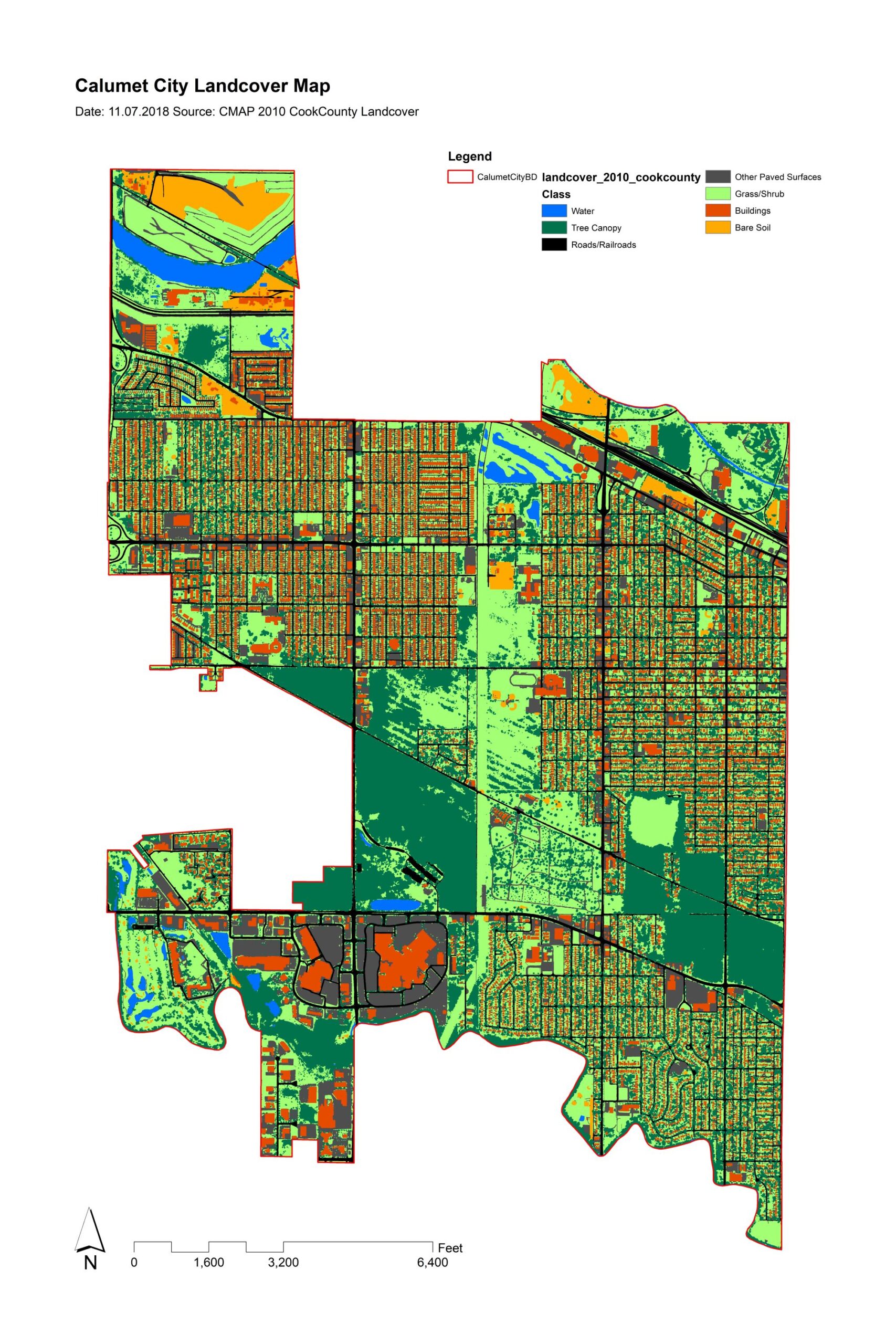
- Surface conditions (for example, aerial image, land use, landcover).
- Soil, surface, site, city, system, regional nested scales.
- Flooding maps and associated analyses (for example, drainage patterns, topographic wetness, flooding susceptibility).
Diagrams can be created initially by hand (on the wall, for example, GSI early site analysis, flooding analysis, GSI design plan, GSI site analysis) and then using formalized landscape design software programs and GIS, or in tools (scaling site analysis).
-
- Feasibility of siting GSI to capture flow along the way, not at the end of the drainage area.
- Community use of the proposed project area(s) (streetscape, shared public land, and private parcels).
- Potential for private land to be part of the GSI design scenario.
- Options for property owners (replacing turf with rain gardens, replacing parking pads and lanes with permeable pavers).
- Using data-informed diagrams in conjunction with one another, including:
Distribute GSI practices within nested scales using diagrams of the project area to construct GSI design scenarios.
- Define scenario scales—lot, parcel, block, several blocks, neighborhood; parcel, sub-catchment, catchment:
- Parcel–sub-catchment–catchment This figure illustrates a conceptual diagram that serves as a preliminary design tool to explore the role and relationships of key GSI design variables.
- Provide context for the scenario scales (sewer atlas, overland flow analysis, catchment/sub-catchment delineation, other):
- Sub-catchment delineation This figure illustrates a sub-catchment delineation showing the nesting of scales in the project area.
- Create multiple diagrams of varying GSI feature distributions at varying scales:
- Site scale GSI design prototypes & surface options.
- Distribute site-scale GSI design prototypes across the project area.
- Neighborhood scale feature distributions.
- Streetscapes.
- Site Plan.
Because different configurations of distributed neighborhood-scale GSI perform differently than the sum of individual site-scale GSI, optimizing for the chosen performance metric(s) requires adjusting and modeling the GSI design scenarios. These renderings can be used in community outreach to inform a bottom-up siting process for GSI at scale.
- Through community engagement:
- Assess if there are additional stakeholders not previously identified that need to be invited into the process (for example, private land owners).
- Assess if the outreach approach needs to be revisited (size of groups, type of engagement).
- Convene community engagement events and get input into GSI design scenarios.
- Assess potential for GSI design scenarios to achieve performance metrics, including cost and performance standards requiring significant retrofit of urban land and revise GSI design scenarios as needed.
Resources
GSI In Action Calumet Region: examples from pilot communities
Understanding GSI Scales
- Barker, Adam James et al. “Understanding Green Infrastructure at Different Scales: A signposting guide.” (2019).
- Green Infrastructure Vision
Data and Mapping resources
Storm sewershed delineation
Landscape design plans and renderings