A rendering of sand ridges underlying current day Calumet City
Introduction
Two communities, Calumet City and Midlothian, participated in a research study to develop the Green Stormwater Infrastructure (GSI) Design Process. These communities lie within the Chicago-Calumet region (CCR), which is located on three extensive beach ridges, representing former shorelines of the early Lake Michigan coast.
Working with these communities, the research team sought to understand the geology and resulting soils heterogeneity across the CCR and integrate this data into GSI performance modeling to design more effective green infrastructure.
Explore each of the GSI design process steps below to learn more about these communities and the research project.
The research study communities were selected, in part, due to prior engagement in GSI planning. Initial community engagement included coordinating with prior GSI plans, including the Calumet City RainReady Plan and the Midlothian RainReady Plan, as well as parallel projects, including the Chicago Metropolitan Agency for Planning Local Technical Assistance project in Midlothian. A project committee comprised of community representatives was formed. Established and trusted venues for engagement, such as aldermanic meetings, were also leveraged where possible. University researchers, students, and extension personnel were involved throughout the process. A scope of work agreement, including process timeline, partners, and budget was crafted and agreed upon.
The first community engagement meeting focused on communicating project logistics, describing the role of soils in stormwater runoff infiltration, and selecting soils sampling locations. Materials developed for this effort included:
- A simple project overview (example: Calumet City), containing project goals and timeline.
- A basic research project concept diagram, to help explain the interface between GSI and sub-surface soils.
- An overview presentation on soil sampling procedures.
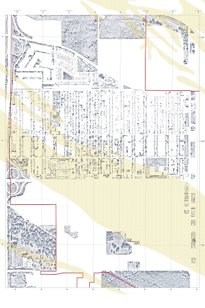
Concurrent with the kickoff meeting, geologic data in the region was collected and summarized and urban surface and land cover conditions were mapped at a regional and municipal scale to assist in identifying site locations. Municipal leaders and community volunteers selected one urban neighborhood in each municipality where problematic and recurring flooding has been observed for the application of the research framework.
After the soil sampling was completed, the results of soils analysis and preliminary hydrologic modeling were shared with the project committee. A second community meeting was held to share initial GSI design concept plans and discuss the performance modeling and preliminary modeled hydrologic impact analysis. At this time, a facilitated discussion was also conducted with the community and the project committee. The GSI design was further refined for more runoff reduction modeling, and the final design plans were shared in a third meeting. The team continued to be involved with the community as it chose to move forward with implementation. The team worked with the community to explore funding opportunities and assist in application preparation.
A mapping analysis was conducted to understand how human activities have shaped the landscape over time and to identify areas of GSI opportunity.
The mapping analysis included surficial geological maps (Bretz map) obtained from the Illinois State Geological Survey Quadrangle Maps. Hydrologic soils data (Hydro soil map) was also examined using data obtained from the Natural Resources Conservation Service web soil survey.
The mapping analysis also included land use data from the Chicago Metropolitan Agency for Planning (CMAP), and aerial data (historic aerial data from the U.S. Department of Agriculture and the University of Illinois MAP Library, and contemporary aerials from the Cook County GIS portal. In addition to land use maps (for example, Calumet City), some of the land use patterns for the Calumet corridor included: transportation, residential-commercial-industrial, green land, vacant land, and civic-public land.
To see how the built environment has evolved over time, aerial images from the early 1960s (Calumet City aerial image, 1961, Midlothian Aerial image, 1961), the late 1980s (Calumet City aerial image, 1988, Midlothian aerial image, 1988), and the 2010s (Calumet Corridor aerial image, Calumet City aerial image, 2016) were examined. Maps were also overlaid with the Universal Transverse Mercator (UTM) coordinate system (Calumet Corridor Aerial with UTM coordination system).
Landcover surface calculations were made for the regional scale (Landcover Calumet Corridor (all types)), the municipal scale (Calumet City detailed landcover), and impervious surface landcover (Landcover impervious area Calumet Corridor). Landcover maps came from the National Land Cover Database, which provided 30m resolution of imperviousness, including buildings. The Cook County GIS portal was used for community-scale data. Maps were then redrawn to capture different impervious types by surface features (roads, alleys, compacted vacant land, etc.).
The CMAP flood susceptibility index was used to prioritize areas that may be more prone to flooding (Flood Index Calumet City, Flood Index Midlothian). Additionally, the mapping analysis highlighted areas of depression (Depression Area Midlothian) using the CMAP ArcHydro Modeling Outputs, 2017, as well as the Topographic Wetness Index (TWI Calumet City, TWI Midlothian).
Several comparative analyses were conducted, including hydrologic soils and land cover data (Hydro soil-landcover) and ground conditions and land use (Land use-aerial image Midlothian).
The Calumet Stormwater Collaborative identified the lack of native soils data as a barrier to advancing stormwater infrastructure design and planning in the CCR. The consequence of this is inaccurate stormwater runoff performance predictions and inefficient infrastructure design.
To address this soils data gap, the research team worked with the two pilot communities, Midlothian, with predominantly fine-grained soils, and Calumet City, with predominantly sandy soils. The team compiled existing soils data, filled in data gaps through field investigations of 5 to 7 sites in each community, and made the results publicly available (ILWATER).
Detailed auger and boring soil sample descriptions were recorded. Particle size fractions (particle size data) and water content were analyzed. Saturated hydraulic conductivity, Ksat were calculated, and Ksat values were compared with soil textural data. Soils texture was divided into three general categories: coarse-grained (sand, loamy sand, and sandy loam textures), mixed (loamy to clay loam textures), and fine-grained (silty clay loam to silty clay textures) (Ksat and soil texture categories).
This soils data was used in combination with other variables to inform optimal GSI Design.
Green stormwater infrastructure design scenarios were created for planted and paved designs considering the relationships between depth, loading ratio, soils, and weather (GSI concept methodology) and modeling runoff reduction using the U.S. Environmental Protection Agency Storm Water Management Model.
Fragility curves and design prototypes allow designers to frontload targeted GSI performance (runoff reduction) into initial design and siting, taking the site’s native soils characteristics into consideration (see the sizing tool for a visualization of this research).
Design prototypes were then scaled from small sites, such as parcels, to neighborhood-scale design scenarios. At this stage, the design research translated engineering modeling into compelling imagery; and two pilot design scenarios that improve the neighborhood’s urban landscape on a scale needed to optimize GSI investments. These renderings were built on previous data visualizations, such as flood maps (example: Midlothian) and volumetric reduction that could be achieved in each subcatchment via green infrastructure. (example: Calumet City).
Initially, GSI design scaling was done by hand (example: hand drawing of site analysis) and then, using more formalized landscape design software programs and GIS, or in tools (Midlothian design concepts for scaling, Calumet City site plan design, Midlothian site plan design, Midlothian plan sections design, street view).
Midlothian selected the Jolly Homes neighborhood for this GSI research project. Field soils investigations showed that Jolly Homes has native soils of a mixed-texture sandy loam, with relatively high infiltration, and remnant prairie and savannah glacial coastal landscape types.
Site visits revealed how the apparent flatness of the landscape can be deceiving, revealing low spots where water collects and pools. We delineated the Midlothian study area into subcatchments and used the U.S. EPA Storm Water Management Model to model performance for proposed GSI in each subcatchment.
We developed a proposed site concept plan to complement a CMAP LTA assistance project to update the village’s capital improvement plan. This plan took into consideration performance modeling, as well as flooding susceptibility, reconnecting to adjacent prairie preserves, soils, existing drainage patterns (showing predevelopment steam condition of 151st street), and more. We located opportunity design areas in the neighborhood. In the process, we also identified activity opportunities complementary to GSI that can benefit the community (ice skating rinks, connecting bike routes, connecting to school areas).
Research into native plant communities resulted in a planting selection that would adapt well to the urban conditions. This included consideration of plant communities by layer (for example, herbaceous, woody), light exposure (for example, sun) as well as wetness gradients (for example, arid, saturated). The resulting designs were calibrated in sectional street-level designs (dry, typical, wet).
We determined that overland flow is a driving factor of flooding in Midlothian, and used MIKE URBAN in combination with fragility curves, to account for variability and uncertainty in GSI design factors, and represent the reliability of GSI performance for various rainfall events (for example, modeled runoff reduction results for a 2 inch, 2 h design storm). This revealed the need to design for rain infiltration upstream in the catchment, to the aggregate loading ratio at points farther downstream in the neighborhood catchment.
In response, we investigated the role of GSI installation in private backyards for a single subcatchment in the northwest area of the Midlothian neighborhood (GSI on private land). With private backyard GSI installed as rain gardens, this subcatchment could prevent a modeled 65,800 gallons of stormwater from entering the downstream subcatchment in response to a 2-inch, 2-hour storm. In this Midlothian catchment, GSI can play a strong role in reducing floods by infiltrating runoff at upstream locations in the catchment.
Calumet City, situated on the eastern edge of the Calumet Corridor, has sandier soils than Midlothian. The selected project area, a 250-acre northwest neighborhood of Calumet City, sits in a low-lying area of land that experiences frequent flooding with an under-capacity sewer system, and due to its low slopes, cannot convey water to the large central detention pond located north of the site.
Field soils investigations revealed that much of the near-surface materials consist of loamy fine sand to loose beach sand—typical of the coastal region. Sands have high infiltration capacity, and when layered beneath green infrastructure—for both planted and permeable paved upper surface designs—they promote direct infiltration. Thus our GSI design reflected how sandy soil substrate and green infrastructure would perform together.
We studied the pattern of low and high areas in the neighborhood and developed a matrix of GSI design surface types for streets, a public park, a commercial parking lot, and a schoolyard. The planting strategy and palette contains species predominantly native to the region. We delineated the Calumet City study area into subcatchments and used the U.S. EPA Storm Water Management Model and fragility curves to model performance for proposed GSI in each subcatchment.
In the Calumet City GSI model, we found that the existing sewer design presented a significant limitation. In the Calumet City catchment, land parcels drain primarily to the street rather than presenting overland flow conditions like the Midlothian catchment. A lack of detailed information about the existing Calumet City storm sewer, along with undersized portions of the storm sewer, presented flooding challenges and required a different modeling approach. We estimated the volume of water removed through the GSI design in public areas using Green-Ampt infiltration for a simulated 2-inch, 2-hour storm. With the simulated design for a 2-inch, 2-hour storm, we estimate that GSI could prevent 1.43, 1.72, and 3.35 million gallons of stormwater from entering the sewer mains along Yates St., State St., and Stewart Ave., respectively, in the catchment. In the Calumet City catchment, additional engineering details regarding the land parcels are needed to proceed with GSI implementation.